Please see the below weather update from the National Weather Service (NWS) New Orleans / Baton Rouge.
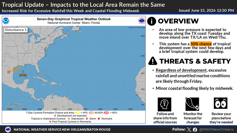
The Hurricane Center is continuing to monitor a trough of low pressure located over northeastern Mexico which is producing a large area of disorganized showers and thunderstorms.
Development is not expected during the next day or so while the trough remains inland. However, the system could re-emerge over the northwestern Gulf of America late Tuesday or Wednesday, and environmental conditions there are marginally conducive for the formation of a short-lived tropical storm on Wednesday into Thursday.
Regardless of tropical cyclone formation, interests across southern and eastern Texas and portions of Louisiana and Mississippi should prepare for periods of intense rainfall over the next several days.
* Formation chance through 48 hours...medium...40 percent.
* Formation chance through 7 days...medium...50 percent.
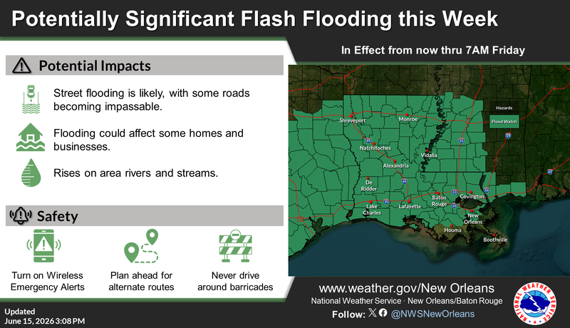
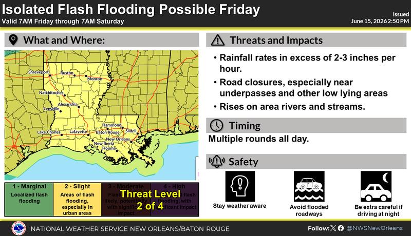
East Baton Rouge Parish is under a Flood Watch through Friday morning.
Multiple rounds of heavy rainfall each day this week. Rainfall totals of 4-6” with locally higher amounts possible for EBR through Friday. The heaviest rainfall is projected for tonight thru Tuesday and on Thursday.


Louisiana State Partners -
Key Changes:
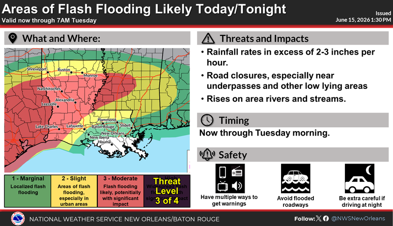
The risk for flash flooding has increased across parts of central, northeast, and southern Louisiana through Friday.
The Flood Watch in southeast Louisiana has been expanded to the US-90 Corridor and extended through 7AM Friday.
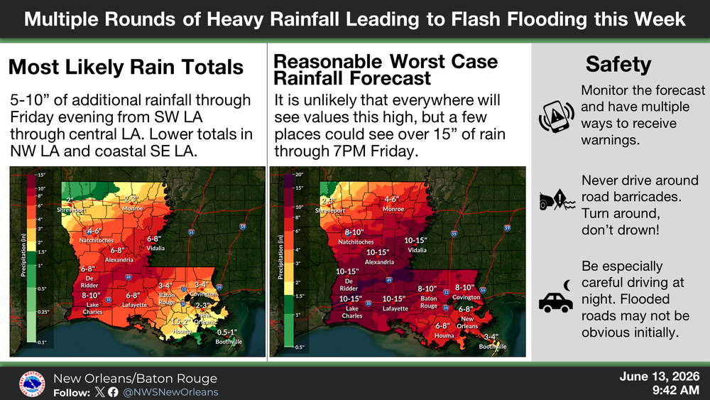
Most likely situation: Multiple rounds of heavy rainfall each day this week. Rainfall totals of 5 to 8 inches with locally higher amounts of up to 10 inches. The heaviest rainfall is projected for Tonight thru Tuesday and on Thursday. Heavy rainfall could lead to flooding of roadways and underpasses and cause moderate flooding on state rivers.
Most Dangerous situation: Multiple rounds of heavy rainfall each day this week. Rainfall totals of 8 to 15 inches with locally higher amounts of up to 20 inches. The heaviest rainfall is projected for Tonight thru Tuesday and on Thursday. The heavy rainfall could lead to extensive flooding of roadways, high water rescues, and cause moderate to major flooding on state rivers.
Rainfall Totals

HEAVY RAIN THREAT TODAY
HEAVY RAIN THREAT TUESDAY THROUGH THURSDAY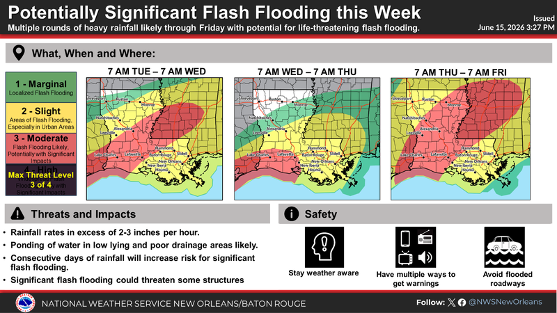
HEAVY RAIN THREAT FRIDAY
FLOOD WATCH IN EFFECT: