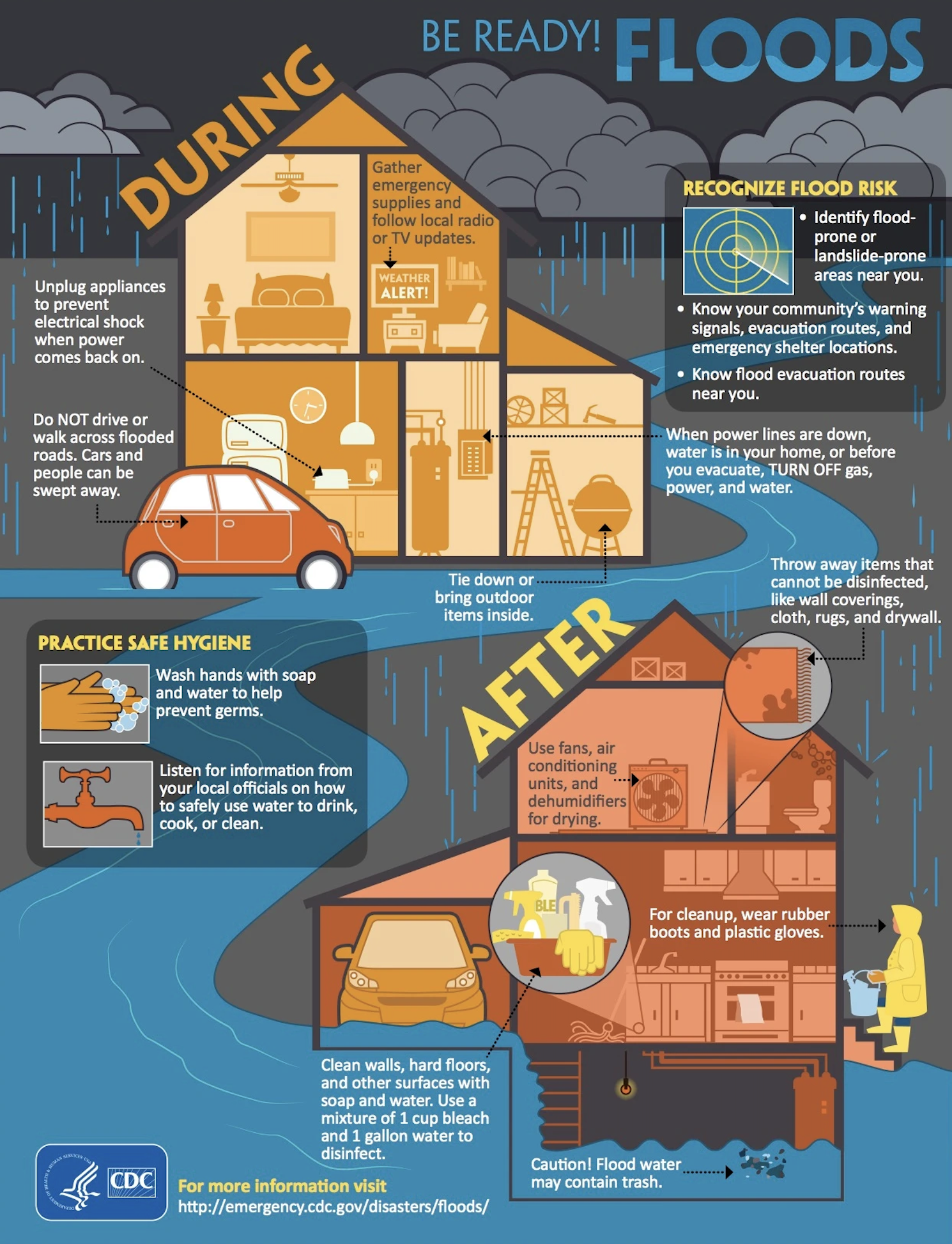
Floodplain Management
Please see the brochures linked below for Floodplain Management & Stormwater Management
These brochures provide information on Floodplain & Stormwater Management regulations in the City of Central; including some new regulations that were recently adopted.
The City of Central's floodplain management office works with citizens each day to know their flood risks.
Some of our services include:
Floodzone Determination Letters
These are formal requests for the floodzone(s) or base flood elevation(s) (BFE) of a property but will also include other flood related information, such as:
Community-Defined Flood Elevation (CDFE);
FIRM panel number(s) & effective date;
Whether your property is located in a Regulatory Floodway;
Whether your property is located in a Conveyance Zone;
Whether your property is in a Repetitive Loss area;
The 2016 flood depth at your property.
A Floodzone Determination Letter could be helpful if you are purchasing a new home, looking at property to develop, purchasing flood insurance, or even if you're just curious. Also, Surveyors that are trying to determine the elevation requirement for a new structure are encouraged to request one. This is a free service.
Important Links
Applying For Letter of Map Amendment (LOMA)
If you have a current Elevation Certificate in hand that indicates that the property is not actually at risk because the elevation data indicates the structure was properly ‘floodproofed’ during design and construction, then you likely meet the minimum qualifications to request removal of the property or structure from the floodplain through the Letter of Map Change process.
FEMA allows all property owners, except those placed in AO flood zones, to submit a Letter of Map Change request for issuance of a LOMA or LOMR or LOMR-F depending upon the individual circumstances of your situation. This can result in the reduction of your flood insurance rates, or the removal of the requirement for flood insurance on the structure.
Provide Elevation Certificate For Structures Built After 2008
The floodplain management office should have a record of your flood elevation certificate if construction of your structure was completed after 2008. Here is a list of properties that have an Elevation Certificate on file.
NFIP and CRS
The City of Central is proud to participate in the National Flood Insurance Program (NFIP). We also participate in the Community Rating System (CRS) to help flood insurance policy holders receive discounts on their flood insurance premiums.
Here's a message from Mayor Evans on the importance of making sure that your home is properly insured with a separate Flood Insurance Policy.