Please see the below weather update from the National Weather Service (NWS) New Orleans/Baton Rouge and the National Hurricane Center.
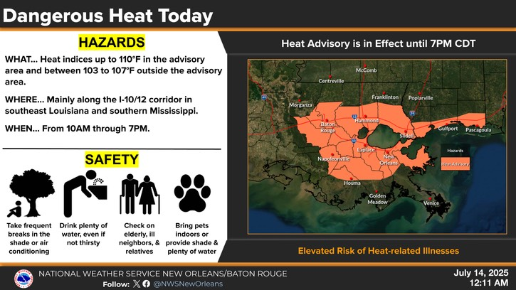
- East Baton Rouge Parish is under a Heat Advisory today until 7:00 PM this evening.
- Heat indices are expected to reach up to 110 degrees.
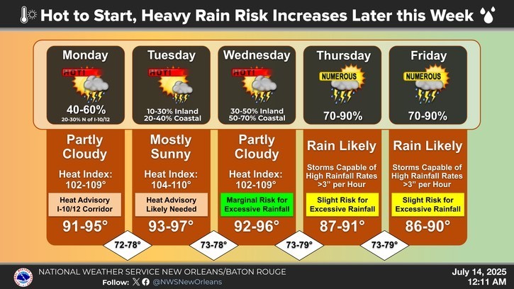
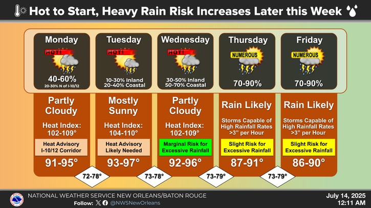
- Heat indices will continue to approach 110 degrees through Wednesday.
- Tuesday will be the hottest day of the week where afternoon storms will be more isolated than other day.
- Storm chances increase quickly into the latter half of the week as a disturbance in the Gulf brings tropical moisture over the area.
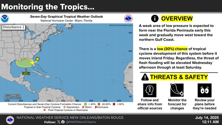
- The National Hurricane Center is monitoring the Gulf as there is a low (30%) chance of tropical development in the next 7 days.
- This area of low pressure is currently located offshore the east coast of Florida which is producing disorganized showers and thunderstorms.
- This disturbance is forecast to move westward across Florida during the next day or so, and into the northeastern Gulf by late Tuesday.
- Environmental conditions appear favorable, and some gradual development of this system is possible while it moves westward to west-northwestward across the northeastern and north-central portions of the Gulf during the middle to latter part of this week.
- Regardless of development, heavy rainfall could produce localized flash flooding over portions of Florida and the north-central Gulf coast through the middle to latter portion of this week.
- Formation chance through 48 hours...low...10 percent.
- Formation chance through 7 days...low...30 percent.