
Please see the below weather update from the National Weather Service (NWS) New Orleans / Baton Rouge.
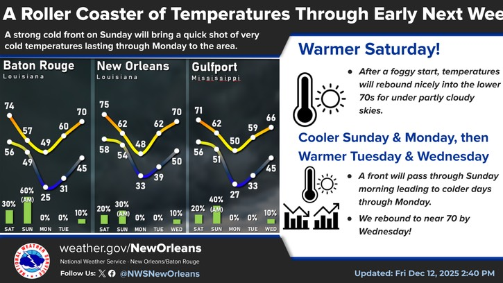
- A roller coaster of temperatures will happen this weekend into early next week as a strong cold front passes through the region.
- High temps will range from the 70s on Saturday to the 40s on Monday and then back to the 70s on Wednesday. Low temps will range from the 50s tonight to the 20s and lower 30s Sunday night before rising into the upper 40s by Tuesday night.
- Rain chances will be highest when the front moves through late Saturday night into Sunday morning, but the rain will be light.
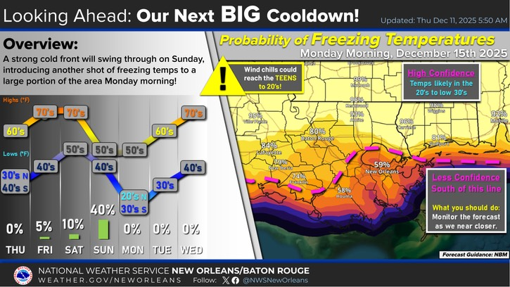
- A strong cold front will swing through on Sunday, introducing another shot of freezing temperatures to the area Monday morning.
- High confidence of freezing temperatures along and north of I-10/12, but lower confidence for the Southshore.
- Regardless, wind chills could reach the teens for northern areas to 20's for most of the area Monday morning. If the worst case comes to pass, we could see lows in the mid-teens to low 20s.

Main Takeaways:
- Arctic air is on the way early next week
- Forecast Low Temperatures well below freezing north and at or just below freezing south for Sunday night into Monday
- Worst case possibilities of lows reaching the teens to low 20s
- Advisories are likely to be issued
- High winds/waves are expected over lakes and coastal waters.
- Sunday into Monday
- A Gale Warning is likely to be issued