
Severe Weather Update 01.08.26
🌧️ Heavy Rain Ahead – Stay One Step Ahead! 🌊
The forecast calls for intense rainfall, but do you know how it will impact YOUR area? Our real-time flood depth forecasts help you stay prepared and make informed decisions before the water rises.
🚨 Check your location now:
Don’t wait for the flood—get ahead of it! #FloodForecast #StaySafe #BePrepared
Be sure to read the disclaimer and info button top right of the map to understand how this data is derived and should be used.
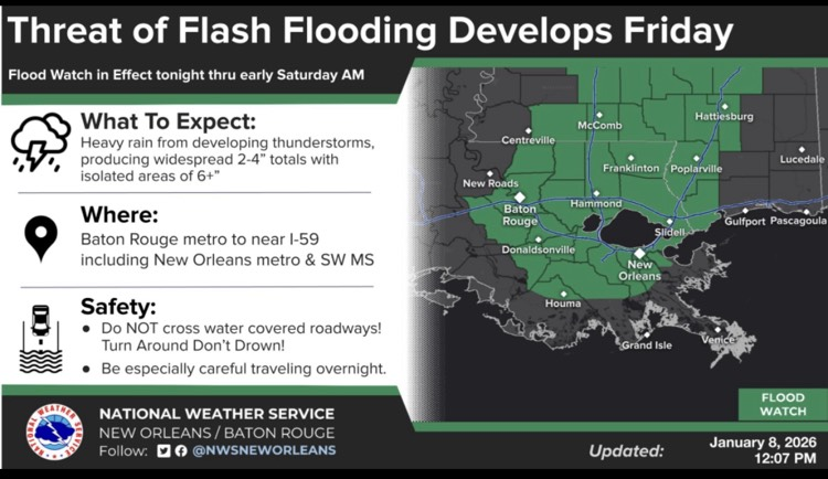
Please see the below weather update from the National Weather Service New Orleans / Baton Rouge.
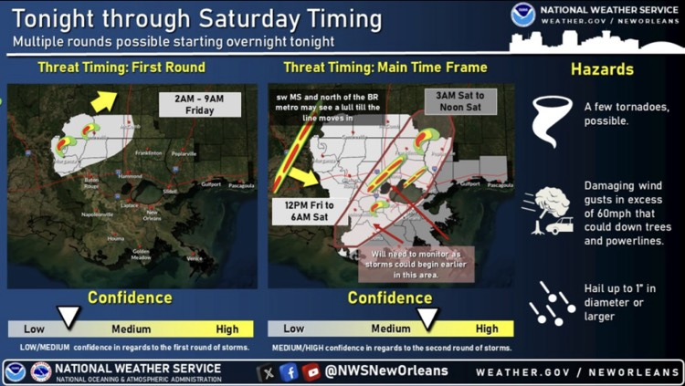
- Slight risk of severe weather and excessive rainfall for our area Friday through Saturday morning.
- All modes of severe weather are possible.
- East Baton Rouge Parish is under a Flood Watch beginning at midnight tonight through 9:00 AM Saturday morning.
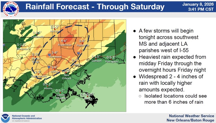
- Rain will begin tonight but the heaviest rainfall is expected around midday Friday through the overnight hours Friday night.
- 2-3” of rainfall with locally higher amounts possible tonight through Saturday.
- Marginal risk of severe weather Saturday with showers lingering into the late morning and midday hours.
- Dry and colder weather forecasted for our area Saturday night through next week.
- Monday morning lows range from mid 20s to upper 30s with min wind chills form the lower 20s to mid 30s.
- Cold Weather Advisories and perhaps Freeze warnings could be needed.

Main Takeaways:
- Multiple Round and multiple hazard event possible overnight tonight through Saturday morning.
- Slight Risk of severe weather for most of the area Friday and Friday night
- Slight Risk of excessive rainfall for much of the area Friday and Friday night.
- Flood Watch issued for Friday and Friday night