Please see the below weather update and attached slides from the National Weather Service (NWS) New Orleans / Baton Rouge.
- Tonight
- Cold front passing through tonight with light rain. 40% chance of showers, mainly before 2AM. Mostly cloudy, with a low around 46.
- Saturday
- Mostly cloudy and highs in the 50s during the day and lows in the 30s at night.
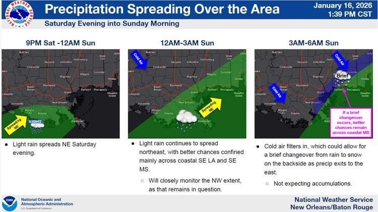
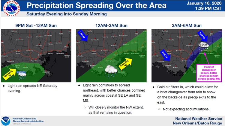
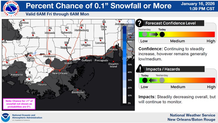
- Chances for snow Saturday night into Sunday morningcontinue to diminish (especially snow that accumulates). Less than a 4% chance of EBR getting less than a tenth of an inch.
- Antecedent ground conditions will be mild (highs today at/near 70), eliminating risk for any snow (that does occur) to accumulate quickly.
- Cold weather forecasted Sunday – Tuesday.
- Morning lows in the mid to upper 20’s and wind chills into the low to mid 20’s.
What has Changed Since Yesterday:
- Chances for snow (especially snow that accumulates) continues to diminish, with a slight increase in forecast confidence.
- Potential for minor impacts is lowering.
- Not expecting a Winter Weather Advisory at this time.
- However, we still could see a brief changeover from rain to snow on the back end of the precipitation mainly early Sunday morning before sunrise.
Cold Weather:
- Otherwise, turning cold again Sunday, Monday and Tuesday mornings with lows in the mid to upper 20’s for the northern ⅓of the area.
- Cold wind chills down into the low to mid 20’s northern areas Sunday and Tuesday mornings.
No additional updates will be sent, unless there are any significant changes.