Please see the below weather update and attached slides from the National Weather Service (NWS) New Orleans / Baton Rouge.
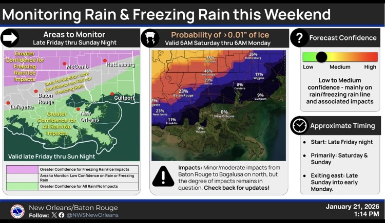
- The NWS is continuing to monitor the potential for freezing rain/ice this weekend.
- The highest probabilities for freezing rain & associated ice accumulation will be north of a Baton Rouge to Bogalusa line with the greatest threat in Southwest Mississippi and portions of Louisiana north of New Roads to Kentwood line.
- Approximate timing. Start: Late Friday night, Primarily Saturday and Sunday, Exiting east late Sunday into early Monday.
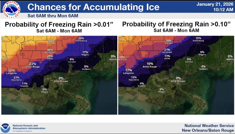
- There is a 23% chance Baton Rouge will receive at least 0.01 inch of freezing rain or ice. There is a 10% chance Baton Rouge will receive 0.10 inch or more of freezing rain or ice.
- Extreme cold temperatures & wind chills are expected across the area Sunday through Tuesday.