Please see the below weather update and attached slides from the National Weather Service (NWS) New Orleans / Baton Rouge. As well as, attached briefing slides from Jay Grymes, State Climatologist.
There are no major changes in the forecast since yesterday’s weather update.
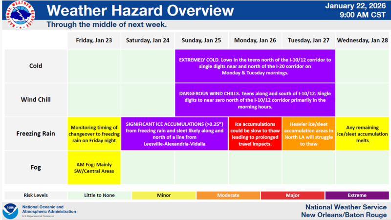
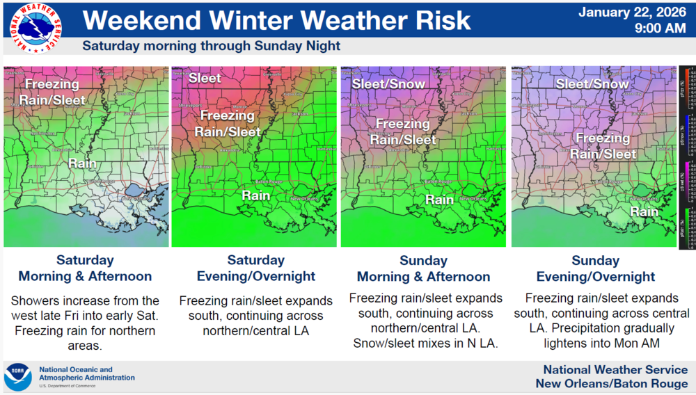
NWS is closely monitoring potential impacts associated with an approaching winter storm impacting the southern/eastern US Friday night through Sunday night then extreme cold weather Sunday through Tuesday.
Onset begins in North Louisiana Friday night and spreads southeast through Saturday and Sunday.
East Baton Rouge Parish is currently included in a Winter Storm Watch beginning Sunday night at midnight through 6:00 PM Sunday evening.
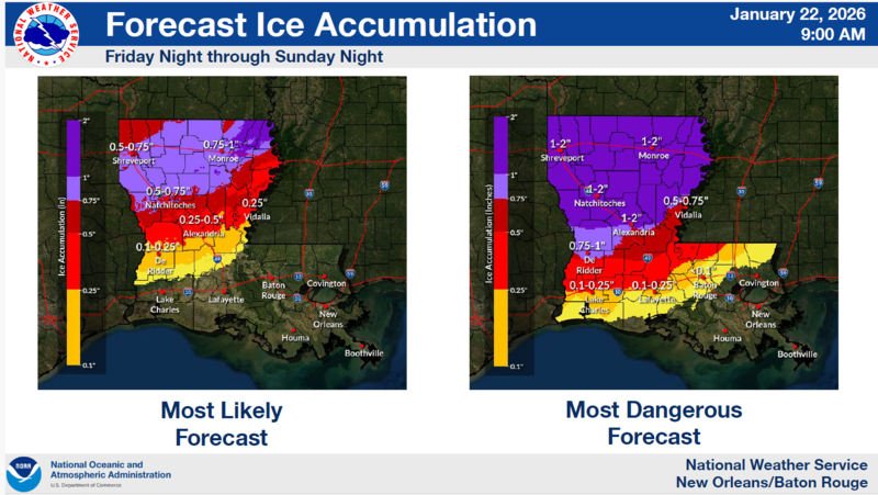
Confidence is low that the winter threat will reach as far south as the I-10/12 corridor, but chances are not zero. Uncertainty remains high in the watch area. A few degrees will be the difference between cold rain & icy roads.
Areas within the Winter Storm Watch could see ice accumulations up to one tenth of an inch (0.1") with localized higher amounts up to one quarter of an inch (0.25") in parts of Southwest MS counties as well as Pointe Coupee and West/East Feliciana.
Hard freezes and dangerous wind chills are forecasted across the entire state Sunday through Tuesday mornings.