Please see the attached slides and below weather update from the National Weather Service (NWS) New Orleans / Baton Rouge. No major changes.
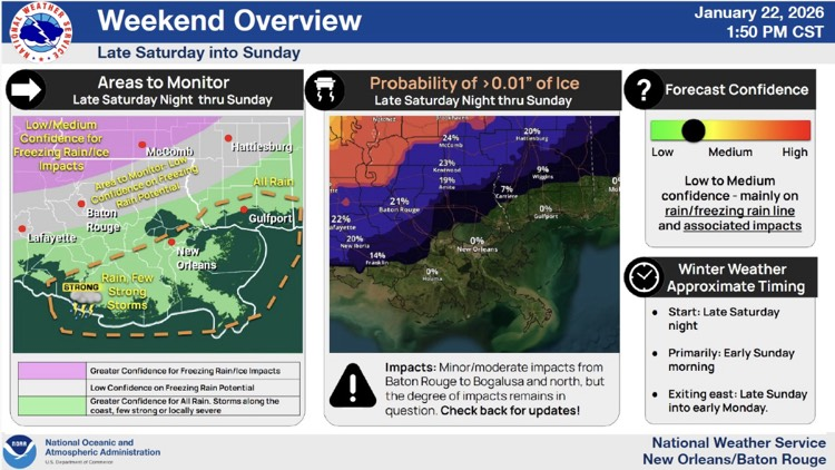
- There has been a trend towards slightly warmer forecast conditions, however, still targeting potential freezing rain/ice accumulations for NW areas late Sat into Sunday.
- East Baton Rouge Parish is currently included in a Winter Storm Watch beginning Sunday night at midnight through 6:00 PM Sunday evening.
- 21% probability of >0.01" of Ice late Saturday Night thru Sunday.
- Could see a few periods of rain, primarily Saturday afternoon into night, another Sunday morning before exiting east Sunday night.
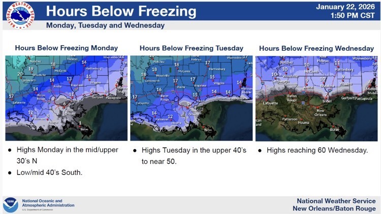
- High confidence in frigid, cold temperature and wind chills will lead to impacts across the majority of southeastern LA and southern MS Sunday Night through Tuesday.


Overview:
- We are continuing to closely monitor impacts associated with an approaching winter storm impacting the southern/eastern US this weekend.
What has Changed Since Yesterday:
- There has been a trend towards slightly warmer forecast conditions, however, still targeting potential freezing rain/ice accumulations for NW areas late Sat into Sunday.
- Winter Storm Watch in effect from Baton Rouge to Tylertown line, to the northwest.
- Could see a few periods of rain, primarily Saturday afternoon into night, another Sunday morning before exiting east Sunday night.
- Few strong storms along the coast will be monitored.
Frigid, cold temperatures to follow
- High confidence in frigid, cold temperature and wind chills will lead to impacts across the majority of southeastern LA and southern MS Sunday Night through Tuesday.