Please see the below weather update from the National Weather Service (NWS) New Orleans / Baton Rouge.
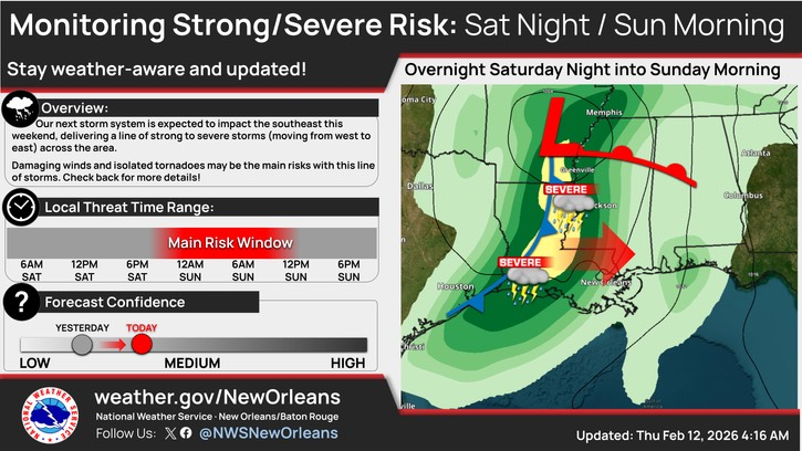
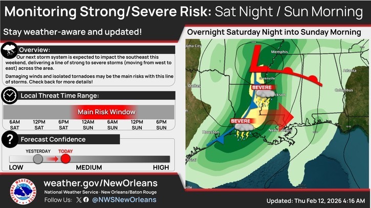
- Greatest concern will be potential for thunderstorms and gusty winds Saturday evening through Sunday morning possibly affecting some parade activities and other outdoor events.
- Showers/storms will come in two main rounds:
- Round one - Scattered showers and a few storms Saturday afternoon/evening.
- Should mainly be passing light to moderate showers. Rain totals are currently forecast to be less than 0.25” before midnight area-wide, with less than 0.1” for most places east of I-55.
- Round two - A squall line of stronger storms Saturday nightinto Sunday morning.
- Trends have been “less good” for Sunday morningduring parade lineup times - especially for areas east of I-55.
- Need to continue monitoring timing trend as the line could slow further.
- Less than 1” of rainfall is forecasted for our area Saturday through Sunday. However, locally higher rainfall amounts are possible.