Please see the below weather update from the National Weather Service New Orleans / Baton Rouge.
- There is a slight risk of severe weather and heavy rainfall for our area tonight.
- All modes of severe weather will be possible - damaging winds, hail, and a few tornadoes.
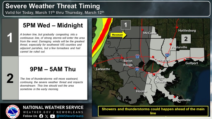
- Timing for EBR is from 5PM this evening through midnight.
- 1” – 2” of rainfall is forecasted for our area tonight with locally higher amounts possible.
Southeast Louisiana and Southern Mississippi partners -
Here is an update concerning the severe weather threat today into early tomorrow morning.
Changes from previous update:
· The timing has sped up.
Overview:
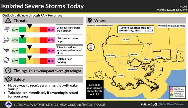
WHAT: SLIGHT RISK of Severe Weather
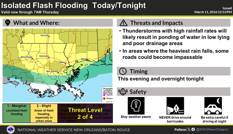
MARGINAL RISK to SLIGHT RISK of Heavy Rain that could lead to flash flooding
WHEN: This evening into the early morning hours Thursday
WHERE: All of southeast Louisiana and south Mississippi
CONFIDENCE:
· We have high confidence a line of thunderstorms will cross the area Wednesday evening into early morning Thursday. We have lower to medium confidence that embedded storms in the line will become severe.
· We have lower confidence that this line of storms will result in any flash flooding.
Impacts:
The main threats associated with any severe storms will be:
· Wind gusts greater than 60 mph are possible.
· Large hail of up to 1 inches in diameter will be possible.
· A few tornadoes are possible.
· Isolated flash flooding is possible in areas with high rainfall rates. Ponding of water is likely in low lying and poor drainage areas.
The attached graphics highlights the threats associated with this system: