Please see the below weather update from the National Weather Service New Orleans / Baton Rouge.
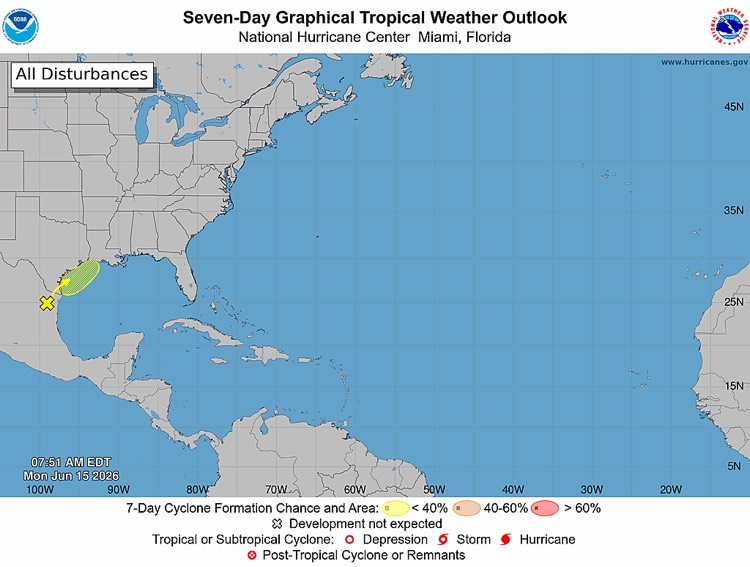
- The NWS and Hurricane Center are currently monitoring a trough of low pressure located over northeastern Mexico which continues to produce disorganized thunderstorm activity. The system is forecasted to move northeastward and could re-emerge over the northwestern Gulf of America late Tuesday or Wednesday where environmental conditions may support some development around midweek. There is currently a 30% chance of formation over the next 7 days.
- East Baton Rouge will be under a Flood Watch beginning 7AM tomorrow and lasting through 7AM Wednesday.
- The NWS is currently forecasting 4-6” of rainfall for our area Monday through Thursday with locally higher amounts possible.