Please see the below weather update from the National Weather Service New Orleans / Baton Rouge.
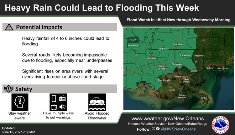
- East Baton Rouge is under a Flood Watch until Wednesday at 7:00 AM.
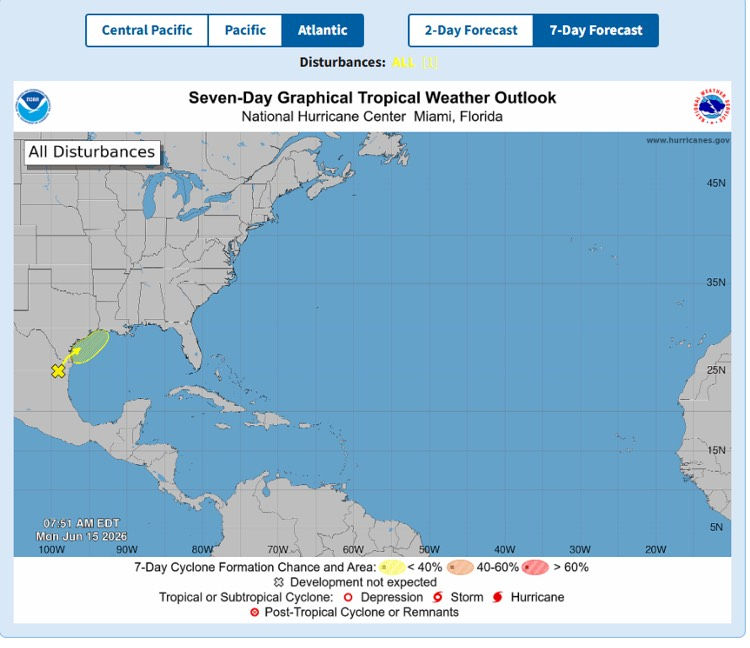
- The NWS and Hurricane Center are still monitoring a trough of low pressure located over northeastern Mexico which continues to produce disorganized shower and thunderstorm activity.
- Development is not expected during the next day or so while the trough remains inland and drifts generally northward over northeastern Mexico and southern Texas.
- The system is then forecast to move northeastward and could re-emerge over the northwestern Gulf of America late Tuesday or Wednesday, where environmental conditions may support some development around midweek.
- Regardless of tropical cyclone formation, heavy rainfall, flash flooding, and gusty winds are possible across portions of eastern and southern Texas and Louisiana this week.
- * Formation chance through 48 hours...low...20 percent.
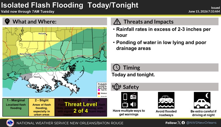
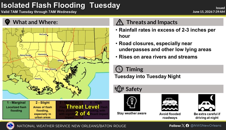
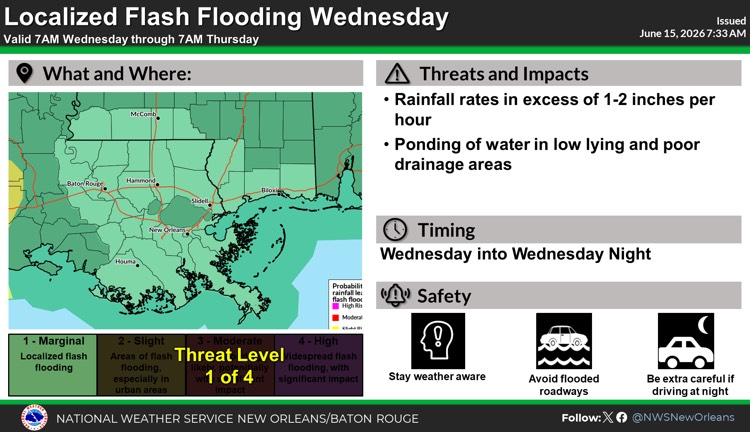
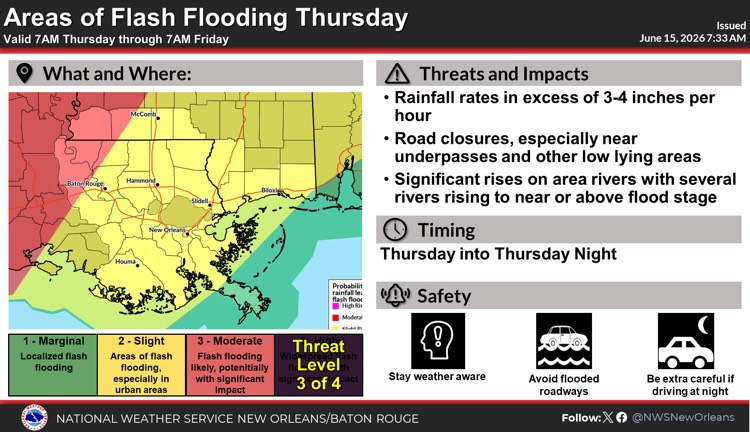
* Formation chance through 7 days...low...30 percent. - Rainfall of 4 to 6 inches is currently forecasted for our area through Friday with locally higher amounts possible.
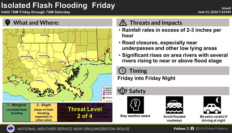
- There is a high chance that high rainfall rates of 2 to 3 inches per hour will result in several areas of flash flooding.
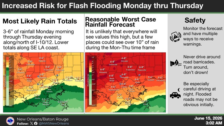
- Multiple rounds of heavy rainfall will occur each day this week, but the heaviest rainfall is projected to occur on Thursday as a low-pressure system moves through the state.

Southeast Louisiana and Southern Mississippi partners -
Here is an update concerning the heavy rain threat this week.
Changes from previous update:
- The threat of heavy rainfall/flash flooding has increased
- The area of greatest threat has expanded
Overview:
WHAT: SLIGHT RISK to MODERATE RISK of Heavy Rain that could lead to flash flooding
WHEN: Multiple rounds of heavy rainfall will occur each day this week, but the heaviest rainfall is projected to occur on Thursday as a low pressure system moves through the state. .
WHERE: All of Southeast Louisiana and Southern Mississippi.
CONFIDENCE: We are confident there will be multiple rounds of thunderstorms that will produce heavy rainfall in the area each day this week, but we have less confidence in exactly where these thunderstorms will develop and where the heaviest rainfall will occur each day.
Impacts:
- Rainfall of 4 to 6 inches is currently forecast through Friday. There is a medium chance of local amounts reaching 10 inches or more.
- There is a high chance that high rainfall rates of 2 to 3 inches per hour will result in several areas of flash flooding.
- As water drains into area rivers, there will be a threat of flooding along some rivers
The attached briefing/graphic(s) below highlights the threats associated with this system.