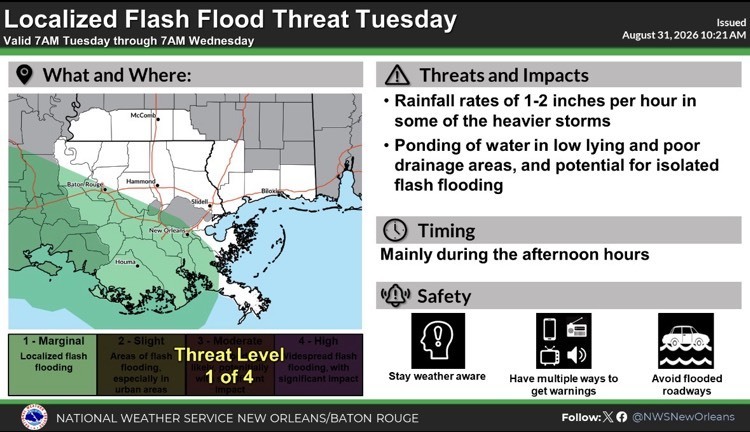
Please see the below update from the National Weather Service New Orleans / Baton Rouge regarding Potential Tropical Cyclone Five.
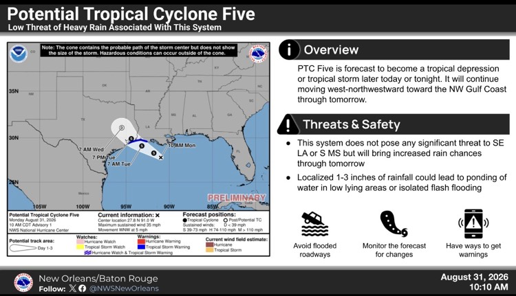
- Potential Tropical Cyclone Five is expected to bring tropical storm conditions to portions of the upper Texas and southwestern Louisiana coasts on Tuesday.
- The system is becoming better organized and there is potential for it to become a short-lived Tropical Depression or Storm.
- While the system does not pose a significant threat to our area, there are increased rain chances for our area throughout the week.
- The NWS is currently forecasting ½” – 1 ½” of rainfall for our area over the next seven days with locally higher amounts possible.
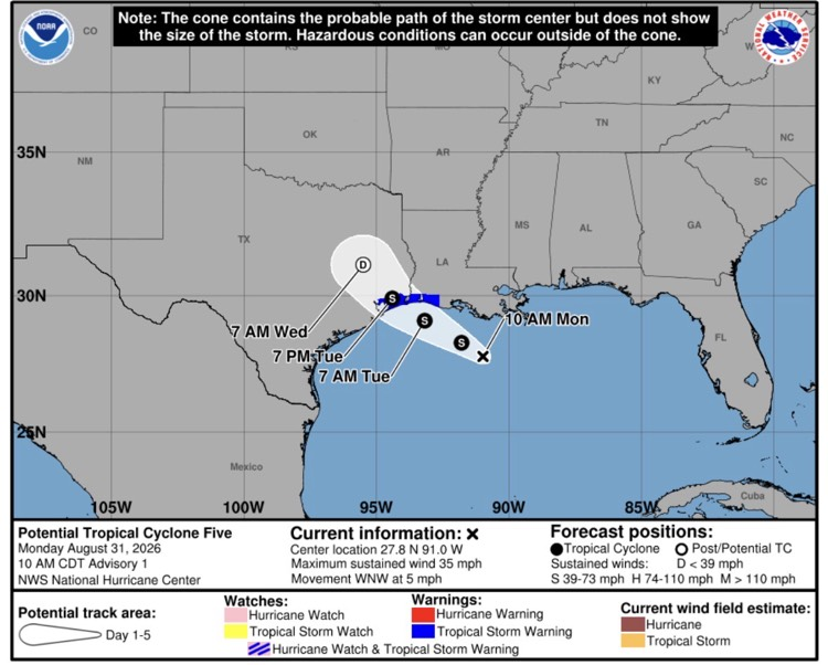
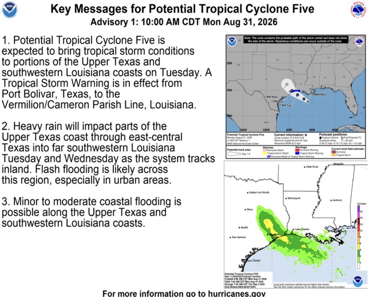

Southeast Louisiana and Southern Mississippi partners -
Here is an update concerning newly designated Potential Tropical Cyclone Five.
Changes from previous update:
- NHC has initiated advisories on Potential Tropical Cyclone Five (PTC5)
- No singificant changes to the local forecast or expected impacts
Overview:
- PTC5 is forecast to become a tropical depression or tropical storm later today or tonight
- It will continue moving generally west-northwestward for the next 24-36 hours before making landfall along the northwestern Gulf coast, likely as a tropical storm
Confidence: Confidence in the overall forecast for PTC 5 is medium given the system has not developed a well defined center yet. However, confidence in the forecast impacts to our local area is high given the system is already moving through the coastal waters and impacts will be mostly west of the local area by tomorrow.
Impacts:
Rainfall/Flash Flooding:
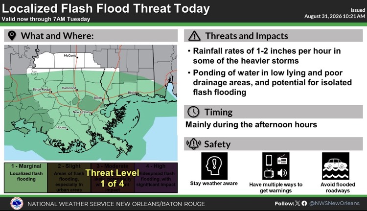
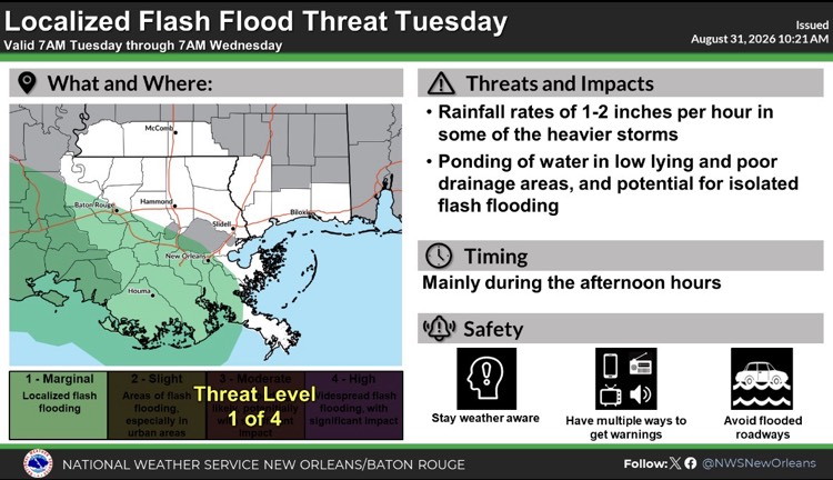
- This system will not bring any widespread, significant impacts to the local area, but it will result in increased rain chances through tomorrow.
- Overall the rainfall forecast through tomorrow is less than one inch, with the highest totals south of the I-10/12 corridor.
- Localized amounts of 1-3 inches from any heavier thunderstorms could lead to ponding of water in low lying or poor drainage areas, or isolated flash flooding.
Marine Impacts:
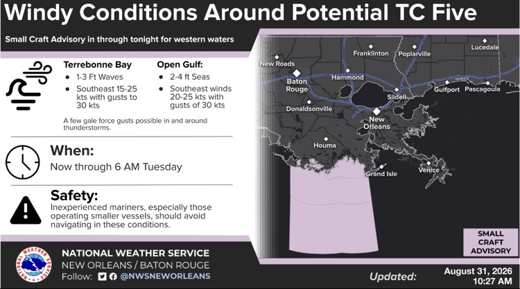
- Increased winds and seas over the Gulf waters west of Port Fourchon will lead to hazardous conditions for small craft.
The graphics below highlight the latest forecast track for PTC5 long with its associated impacts across SE LA and S MS.