Please see the below weather update from the National Weather Service (NWS) New Orleans / Baton Rouge.
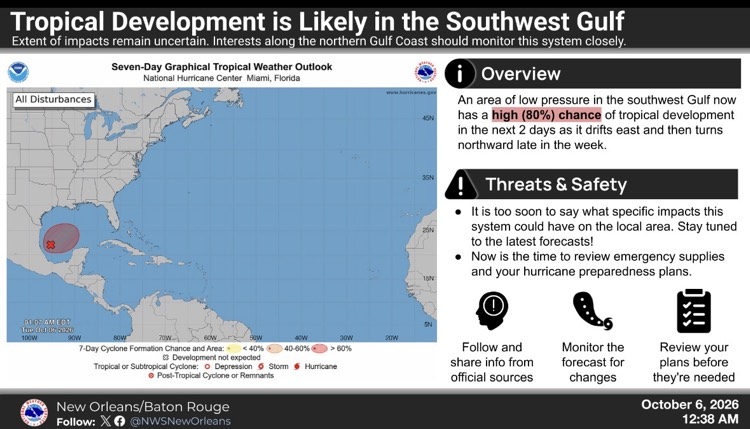
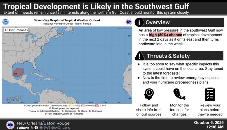
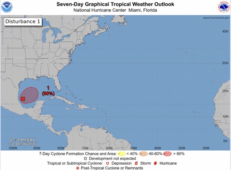
- The NWS and Hurricane Center are monitoring a broad area of low pressure located over the southwestern Gulf.
- Continued development of this system is expected, and a tropical depression is anticipated to form over the next day or so while it drifts eastward.
- The disturbance is expected to turn to the north or northeast toward the northern Gulf Coast by the end of the week.
- It is still too early to determine specific impacts to the northern Gulf Coast, but interests from the Florida Panhandle to Louisiana should closely monitor the progress of this system.
- The NOAA Gulfstream is scheduled to sample the environment over the Gulf later today and an Air Force reconnaissance aircraft is scheduled to investigate the system tomorrow.
- Formation chance through 48 hours...high...90 percent.
- Formation chance through 7 days...high...90 percent.

Southeast Louisiana and Southern Mississippi partners -
Here is an update concerning the potential for tropical cyclone development in the southwest Gulf over the next few days.
Changes from previous update:
- The chance of development over the next 2 days has increased.
Overview:
There is a HIGH (80%) chance of tropical cyclone development over the next 2 days.
- This system is forecast to move generally eastward and then northward and could bring some impacts to the northern Gulf coast in the next 4 to 6 days (generally Friday through Sunday).
- Interests along the northern Gulf coast should monitor the progress of this system.
Confidence:
- Confidence in the development of a tropical depression or storm in the southwest Gulf over the next 2 days continues to increase.
- Confidence is gradually increasing that this system will bring impacts to the northern Gulf Coast, but extent and timing of impacts to the local area remain uncertain.
Impacts:
- Specific impacts will depend on the exact track and intensity of this system. However, there is a chance it will bring a multi-hazard threat to the local area in 4 to 6 days (generally Friday through Sunday). More details will be provided as forecast confidence increases.