
Good Morning,
Please see the below update from the National Weather Service New Orleans/Baton Rouge.
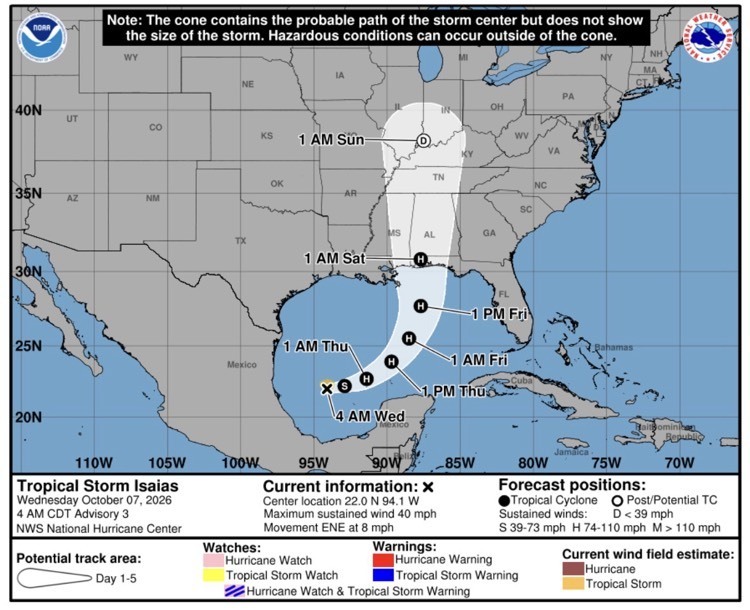
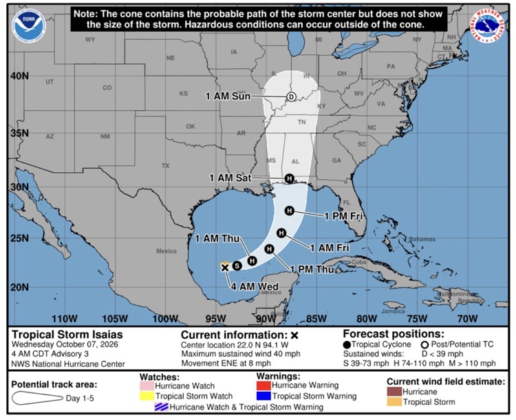
- Tropical Depression Nine has upgraded to Tropical Storm Isaias and is currently forecasted to become a high-end Category 2 hurricane in the next two days as it moves east over the Gulf.
- The forecast intensity has increased and the storm’s track has shifted more eastward from the previous advisory.
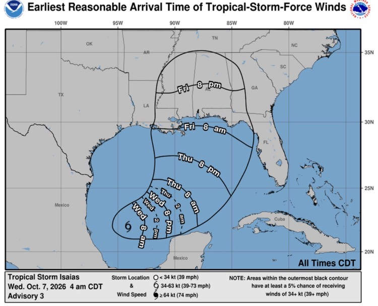
- The storm is forecast to turn north on Friday and accelerate, bringing impacts to the northern Gulf coast by Friday afternoon and into Saturday.
- This storm will likely bring multi-hazard impacts including coastal flooding, excessive rainfall, and gusty winds to the local area.
- Further adjustments to timing and extent of impacts could occur. Continue to monitor this situation closely even if our area is no longer in the cone.
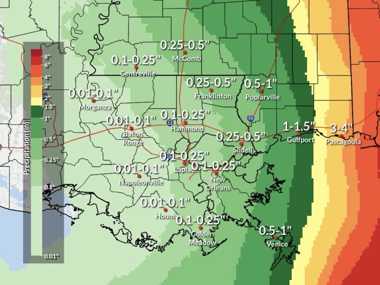
Expected Storm Total Rainfall:

Southeast Louisiana and Southern Mississippi partners -
Here is an update concerning freshly named Tropical Storm Isaias. See the full briefing attached for graphics and full details.
Changes from previous update:
- The forecast track has shifted east from the previous advisory.
- The forecast intensity has increased from the previous advisory.
- Confidence in the extent and timing of impacts continues to increase.
Overview:
- Isaias is forecast to become a high-end Category 2 hurricane in the next two days as it moves east over the Gulf.
- The storm is forecast to turn north on Friday and accelerate, bringing impacts to the northern Gulf coast by Friday afternoon and into Saturday.
- This storm will likely bring multi-hazard impacts including coastal flooding, excessive rainfall, and gusty winds to the local area.
- Further adjustments to timing and extent of impacts could occur. Continue to monitor this situation closely even if you’re no longer in the cone.
Confidence:
- Confidence in the forecast track of this storm is gradually increasing.
- If the current forecast holds, we are confident that minor/moderate impacts will be experienced across portions of Southeast Louisiana and Southern Mississippi.
Impacts:
- Specific impacts will depend on the exact track and intensity of this system as it passes the area. However, it will likely bring multi-hazard impacts to the local area Friday through Saturday.
Storm Surge:
- At least minor coastal flooding is possible today and Thursday and likely on Friday into Saturday.
- At least 1 to 3 ft of inundation is forecast along immediate coastal areas.
- If these values are realized, low-lying, coastal roads will flood and a few could become impassable.
- Higher coastal flooding inundation exceeding 3 feet will be possible for areas east of the Mississippi River such as Waveland and Shell beach, but this will be highly dependent on the track.
Rainfall/Flooding:
- There will be a sharp gradient for rainfall on the west side of the hurricane.
- Coastal Mississippi has the highest chance for locally heavy rainfall of 2 to 5 inches.
- Some areas west of I-55 may see less than 0.5” from this storm.
- Forecast rain totals may continue to decrease if the forecast track shifts farther east.
Wind and Tornado:
- Sustained winds of up to 20 to 30 mph with higher gusts up to 40 to 45 mph are forecast with the strongest winds expected east of the I-59 corridor.
- Winds of this magnitude will blow around lightweight, loose household items and cause hazardous driving conditions, especially on bridges and elevated roadways
- There is a low chance of tornadoes in the storm’s outer rain bands along the Mississippi Coast. Tornadoes in these situations are typically short-lived, but they move very quickly.